
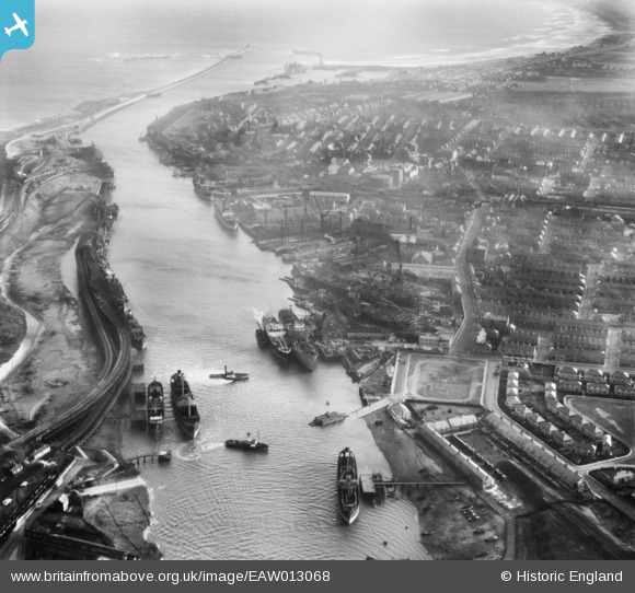
EAW013068 ENGLAND (1948). The Port of Blyth and the town, Blyth, 1948
© Copyright OpenStreetMap contributors and licensed by the OpenStreetMap Foundation. 2024. Cartography is licensed as CC BY-SA.
Nearby Images (25)
EAW013068

EPW019752

EAW014451

EAW013066

EAW014456

EAW014458

EAW013070

EAW013064

EAW013063

EAW014448

EAW013074

EAW014455

EAW014445

EAW014446

EAW013069

EAW013067

EAW013071

EAW014453

EPW048830

EPW048841

EAW013072

EAW014454

EPW048827

EAW014447

EAW014449

Details
| Title | [EAW013068] The Port of Blyth and the town, Blyth, 1948 |
| Reference | EAW013068 |
| Date | 3-February-1948 |
| Link | |
| Place name | BLYTH |
| Parish | BLYTH |
| District | |
| Country | ENGLAND |
| Easting / Northing | 431245, 582043 |
| Longitude / Latitude | -1.5099006298454, 55.131712949895 |
| National Grid Reference | NZ312820 |
Pins
 redmist |
Thursday 31st of December 2020 08:35:01 PM | |
redmist |
Wednesday 6th of November 2019 11:29:52 PM | |
redmist |
Wednesday 6th of November 2019 11:26:37 PM | |
redmist |
Wednesday 6th of November 2019 11:26:01 PM | |
redmist |
Wednesday 6th of November 2019 11:25:24 PM | |
redmist |
Wednesday 6th of November 2019 08:55:42 PM | |
redmist |
Monday 4th of November 2019 10:06:06 PM |


