
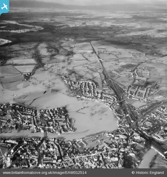
EAW012514 ENGLAND (1948). The River Severn in flood, Shrewsbury, from the south, 1948
© Copyright OpenStreetMap contributors and licensed by the OpenStreetMap Foundation. 2024. Cartography is licensed as CC BY-SA.
Nearby Images (7)
EAW012514

EAW012516

EAW001632

EAW012515

EAW001631

EPW040077

EAW001630

Details
| Title | [EAW012514] The River Severn in flood, Shrewsbury, from the south, 1948 |
| Reference | EAW012514 |
| Date | 14-January-1948 |
| Link | |
| Place name | SHREWSBURY |
| Parish | SHREWSBURY |
| District | |
| Country | ENGLAND |
| Easting / Northing | 349055, 313074 |
| Longitude / Latitude | -2.7542026342106, 52.712583727591 |
| National Grid Reference | SJ491131 |
Pins
Be the first to add a comment to this image!


