
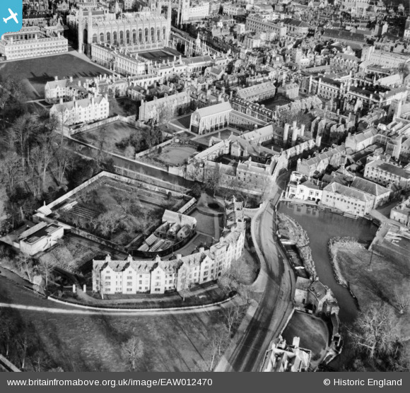
EAW012470 ENGLAND (1947). Queen's College and environs, Cambridge, 1947
© Copyright OpenStreetMap contributors and licensed by the OpenStreetMap Foundation. 2024. Cartography is licensed as CC BY-SA.
Nearby Images (29)
EAW012470

EAW012460

EAW012465

EAW012467

EAW012471

EAW012461

EAW012476

EAW012468

EAW012466

EAW012464

EAW012472

EAW012473

EPW009784

EAW012474

EAW012462

EAW012478

EAW012477

EAW012475

EAW012463

EAW004874

EAW002919

EPW009781

EAW012469

EAW003561

EPW045030

EAW002918

EPW000059

EPW000057

EPW000047

Details
| Title | [EAW012470] Queen's College and environs, Cambridge, 1947 |
| Reference | EAW012470 |
| Date | 31-December-1947 |
| Link | |
| Place name | CAMBRIDGE |
| Parish | |
| District | |
| Country | ENGLAND |
| Easting / Northing | 544636, 258107 |
| Longitude / Latitude | 0.11669608840825, 52.20178706024 |
| National Grid Reference | TL446581 |
Pins
Be the first to add a comment to this image!


