
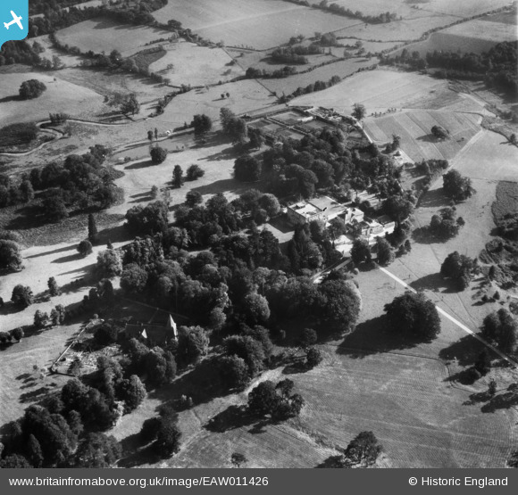
EAW011426 ENGLAND (1947). Buxted Park and St Margaret's Church, Buxted, 1947
© Copyright OpenStreetMap contributors and licensed by the OpenStreetMap Foundation. 2024. Cartography is licensed as CC BY-SA.
Nearby Images (9)
EAW011426

EAW011425

EAW011430

EAW011431

EAW011427

EAW011432

EAW011433

EAW011428

EAW011424

Details
| Title | [EAW011426] Buxted Park and St Margaret's Church, Buxted, 1947 |
| Reference | EAW011426 |
| Date | 1-October-1947 |
| Link | |
| Place name | BUXTED |
| Parish | BUXTED |
| District | |
| Country | ENGLAND |
| Easting / Northing | 548560, 122876 |
| Longitude / Latitude | 0.11680128710923, 50.985549984034 |
| National Grid Reference | TQ486229 |
Pins
 Matt Aldred edob.mattaldred.com |
Sunday 29th of November 2020 04:20:14 PM | |
Matt Aldred edob.mattaldred.com |
Sunday 29th of November 2020 04:19:55 PM | |
 Robnotso |
Friday 19th of August 2016 05:30:22 PM | |
Robnotso |
Friday 19th of August 2016 05:29:19 PM |


