
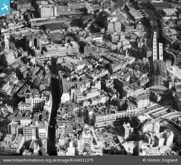
EAW011375 ENGLAND (1947). Fenchurch Street and environs, London, 1947
© Copyright OpenStreetMap contributors and licensed by the OpenStreetMap Foundation. 2024. Cartography is licensed as CC BY-SA.
Nearby Images (20)
EAW011375

EAW004895

EAW011146

EAW021724

EAW011172

EAW011145

EAW035194

EAW004896

EAW011376

EAW011173

EAW048559

EAW035195

EAW035193

EAW035188

EAW011171

EAW011147
 at Trinity Square and environs, London, 1947")
EPW045403

EAW011134

EAW000631

EAW011132

Details
| Title | [EAW011375] Fenchurch Street and environs, London, 1947 |
| Reference | EAW011375 |
| Date | 3-October-1947 |
| Link | |
| Place name | LONDON |
| Parish | |
| District | |
| Country | ENGLAND |
| Easting / Northing | 533418, 181051 |
| Longitude / Latitude | -0.077127283540432, 51.512129153185 |
| National Grid Reference | TQ334811 |
Pins
 Robin |
Sunday 21st of February 2021 01:07:34 PM | |
Hermann the German |
Saturday 26th of August 2017 07:51:58 PM | |
 Class31 |
Monday 12th of May 2014 07:39:14 PM | |
 Alan McFaden |
Tuesday 5th of November 2013 05:09:10 PM |

User Comment Contributions
View looking east. |
Class31 |
Monday 12th of May 2014 07:39:48 PM |


