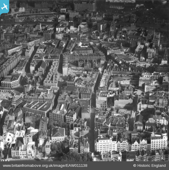
EAW011138 ENGLAND (1947). Scrutton Street and environs, Shoreditch, 1947. This image has been produced from a print.
© Copyright OpenStreetMap contributors and licensed by the OpenStreetMap Foundation. 2024. Cartography is licensed as CC BY-SA.
Nearby Images (4)
EAW011138

EAW011218

EAW011073

EAW011072

Details
| Title | [EAW011138] Scrutton Street and environs, Shoreditch, 1947. This image has been produced from a print. |
| Reference | EAW011138 |
| Date | 30-September-1947 |
| Link | |
| Place name | SHOREDITCH |
| Parish | |
| District | |
| Country | ENGLAND |
| Easting / Northing | 533064, 182253 |
| Longitude / Latitude | -0.081772281860953, 51.523015549461 |
| National Grid Reference | TQ331823 |
Pins
 S00Z |
Monday 25th of September 2017 04:30:04 PM | |
 Class31 |
Tuesday 20th of October 2015 02:43:15 PM | |
Class31 |
Tuesday 20th of October 2015 01:26:05 PM | |
Class31 |
Tuesday 20th of October 2015 01:18:51 PM | |
Class31 |
Tuesday 20th of October 2015 01:16:59 PM | |
Class31 |
Tuesday 20th of October 2015 01:15:43 PM | |
Class31 |
Tuesday 20th of October 2015 01:14:01 PM | |
Class31 |
Monday 19th of October 2015 08:56:01 AM | |
Class31 |
Monday 19th of October 2015 08:54:16 AM |