
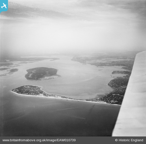
EAW010739 ENGLAND (1947). Sandbanks, Brownsea Island and the Harour, Poole, from the south-east, 1947
© Copyright OpenStreetMap contributors and licensed by the OpenStreetMap Foundation. 2024. Cartography is licensed as CC BY-SA.
Nearby Images (8)
EAW010739

EPW061369

EPW061368

EPW061365

EPW061367

EPW061370

EPW041054

EPW061366

Details
| Title | [EAW010739] Sandbanks, Brownsea Island and the Harour, Poole, from the south-east, 1947 |
| Reference | EAW010739 |
| Date | 10-September-1947 |
| Link | |
| Place name | POOLE |
| Parish | |
| District | |
| Country | ENGLAND |
| Easting / Northing | 404441, 87951 |
| Longitude / Latitude | -1.9371216563275, 50.690614705596 |
| National Grid Reference | SZ044880 |


