
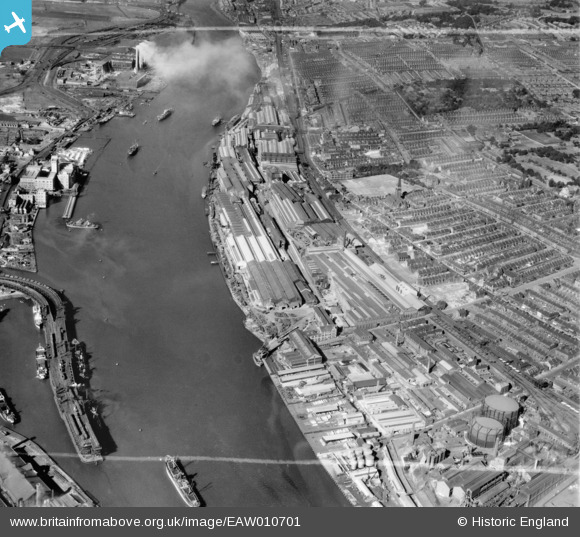
EAW010701 ENGLAND (1947). The Vickers-Armstrongs Ltd Elswick Works and environs, Elswick, 1947. This image was marked by Aerofilms Ltd for photo editing.
© Copyright OpenStreetMap contributors and licensed by the OpenStreetMap Foundation. 2024. Cartography is licensed as CC BY-SA.
Nearby Images (9)
EAW010701

EAW010680

EAW010700

EAW010704

EAW010689

EAW010691

EAW010699

EAW010692

EAW010690

Details
| Title | [EAW010701] The Vickers-Armstrongs Ltd Elswick Works and environs, Elswick, 1947. This image was marked by Aerofilms Ltd for photo editing. |
| Reference | EAW010701 |
| Date | 10-September-1947 |
| Link | |
| Place name | ELSWICK |
| Parish | |
| District | |
| Country | ENGLAND |
| Easting / Northing | 423302, 563027 |
| Longitude / Latitude | -1.6360417232383, 54.961254073508 |
| National Grid Reference | NZ233630 |


