
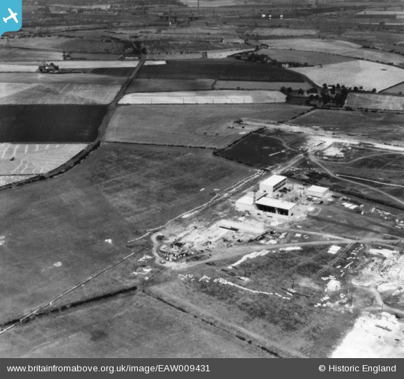
EAW009431 ENGLAND (1947). Petrochemicals Plant under construction, Carrington, 1947. This image has been produced from a print.
© Copyright OpenStreetMap contributors and licensed by the OpenStreetMap Foundation. 2024. Cartography is licensed as CC BY-SA.
Nearby Images (8)
EAW009431

EAW009427

EAW009430

EAW009449

EAW009428

EAW009429

EAW009440

EAW009434

Details
| Title | [EAW009431] Petrochemicals Plant under construction, Carrington, 1947. This image has been produced from a print. |
| Reference | EAW009431 |
| Date | 20-August-1947 |
| Link | |
| Place name | CARRINGTON |
| Parish | CARRINGTON |
| District | |
| Country | ENGLAND |
| Easting / Northing | 373547, 392269 |
| Longitude / Latitude | -2.3981430418473, 53.426290457586 |
| National Grid Reference | SJ735923 |
Pins
 parrot |
Thursday 26th of January 2017 02:42:08 PM |


