
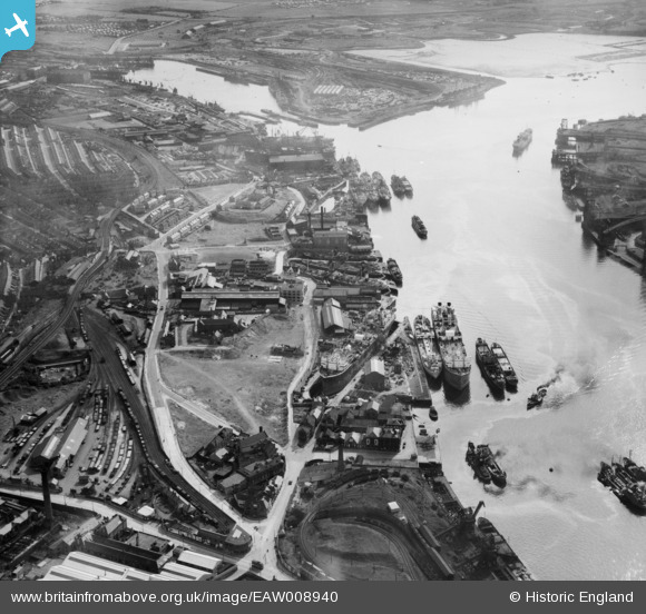
EAW008940 ENGLAND (1947). The Middle Docks & Engineering Company Ltd Ship Repair Yard at Middle Docks and environs, South Shields, 1947
© Copyright OpenStreetMap contributors and licensed by the OpenStreetMap Foundation. 2024. Cartography is licensed as CC BY-SA.
Nearby Images (17)
EAW008940

EAW014534
, South Shields, 1948. This image has been produced from a print.")
EAW014532
, South Shields, 1948. This image has been produced from a print.")
EAW008937

EAW008938

EAW008941

EAW008944

EAW014536

EAW008942

EAW014531
, South Shields, 1948. This image has been produced from a print.")
EAW008939

EAW008934

EAW008943

EAW008936

EAW008935

EAW014530
, South Shields, 1948. This image has been produced from a damaged negative.")
EAW014533
, South Shields, 1948. This image has been produced from a print.")
Details
| Title | [EAW008940] The Middle Docks & Engineering Company Ltd Ship Repair Yard at Middle Docks and environs, South Shields, 1947 |
| Reference | EAW008940 |
| Date | 9-August-1947 |
| Link | |
| Place name | SOUTH SHIELDS |
| Parish | |
| District | |
| Country | ENGLAND |
| Easting / Northing | 435729, 566590 |
| Longitude / Latitude | -1.4415063536199, 54.992538390518 |
| National Grid Reference | NZ357666 |
Pins
 redmist |
Thursday 23rd of November 2023 04:53:29 PM | |
redmist |
Friday 3rd of May 2019 09:45:17 AM | |
N Dunn |
Saturday 20th of October 2018 11:19:45 AM | |
ww |
Wednesday 12th of November 2014 03:55:53 PM | |
ww |
Wednesday 12th of November 2014 03:52:17 PM | |
ww |
Wednesday 12th of November 2014 03:51:30 PM |


