
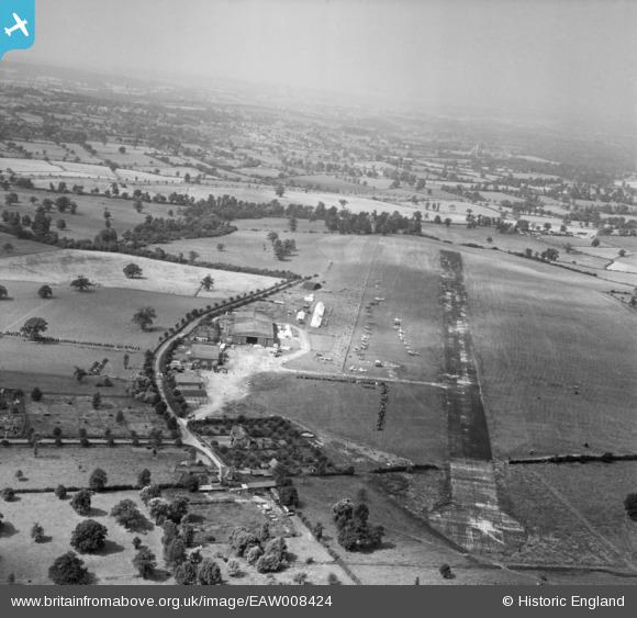
EAW008424 ENGLAND (1947). Aldenham, the United Services Flying Club's Air Display and International Rally at Elstree Aerodrome, from the north-east, 1947
© Copyright OpenStreetMap contributors and licensed by the OpenStreetMap Foundation. 2024. Cartography is licensed as CC BY-SA.
Nearby Images (38)
EAW008424

EAW027497

EAW023639

EAW027500

EAW027495

EAW008427

EAW023637

EAW023636

EAW041152

EAW023632

EAW023640

EAW023641

EAW041155

EAW008428

EAW008425

EAW041154

EAW023638

EAW023635

EAW027665
 at Elstree Aerodrome, Aldenham, 1949")
EAW027657
 in flight over Elstree Aerodrome, Aldenham, 1949")
EAW023634

EAW048859

EAW041239

EAW049283

EAW048860

EAW027658
 in flight at Elstree Aerodrome, Aldenham, 1949")
EAW008426

EAW006988

EAW023633

EAW041153

EAW008421

EAW050518

EAW050519
 at Elstree Aerodrome, 1953")
EAW050520
 at Elstree Aerodrome, 1953")
EAW050521
 at Elstree Aerodrome, 1953")
EAW023631

EAW006987

EAW023645

Details
| Title | [EAW008424] Aldenham, the United Services Flying Club's Air Display and International Rally at Elstree Aerodrome, from the north-east, 1947 |
| Reference | EAW008424 |
| Date | 27-June-1947 |
| Link | |
| Place name | ALDENHAM |
| Parish | ALDENHAM |
| District | |
| Country | ENGLAND |
| Easting / Northing | 516222, 196481 |
| Longitude / Latitude | -0.31973100764398, 51.65462192957 |
| National Grid Reference | TQ162965 |
Pins
Be the first to add a comment to this image!


