
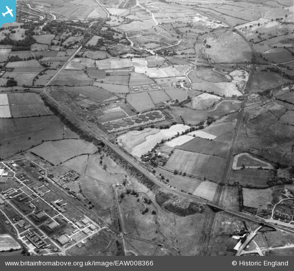
EAW008366 ENGLAND (1947). The Ray Hall Sewage Works and the Tame Valley Canal, West Bromwich, 1947
© Copyright OpenStreetMap contributors and licensed by the OpenStreetMap Foundation. 2024. Cartography is licensed as CC BY-SA.
Nearby Images (2)
EAW008366

EAW008365

Details
| Title | [EAW008366] The Ray Hall Sewage Works and the Tame Valley Canal, West Bromwich, 1947 |
| Reference | EAW008366 |
| Date | 20-July-1947 |
| Link | |
| Place name | WEST BROMWICH |
| Parish | |
| District | |
| Country | ENGLAND |
| Easting / Northing | 402389, 294579 |
| Longitude / Latitude | -1.9647648038798, 52.548692559925 |
| National Grid Reference | SP024946 |
Pins
 redmist |
Sunday 25th of October 2020 11:35:09 PM | |
redmist |
Sunday 25th of October 2020 11:33:28 PM | |
redmist |
Sunday 25th of October 2020 11:33:05 PM | |
redmist |
Sunday 25th of October 2020 11:31:51 PM | |
redmist |
Sunday 25th of October 2020 11:31:20 PM | |
redmist |
Sunday 25th of October 2020 11:30:07 PM | |
redmist |
Sunday 25th of October 2020 11:29:38 PM | |
redmist |
Sunday 25th of October 2020 11:29:10 PM | |
Mikeya |
Wednesday 12th of June 2019 07:32:02 PM | |
Mikeya |
Wednesday 12th of June 2019 07:31:27 PM | |
Mikeya |
Wednesday 12th of June 2019 07:31:15 PM | |
Mikeya |
Wednesday 12th of June 2019 07:30:23 PM | |
Mikeya |
Wednesday 12th of June 2019 07:27:51 PM | |
Mikeya |
Wednesday 12th of June 2019 07:24:51 PM | |
Mikeya |
Wednesday 12th of June 2019 07:20:20 PM | |
Mikeya |
Wednesday 12th of June 2019 07:17:38 PM | |
Mikeya |
Wednesday 12th of June 2019 07:14:03 PM | |
Mikeya |
Wednesday 12th of June 2019 07:13:23 PM | |
Mikeya |
Wednesday 12th of June 2019 07:11:20 PM | |
Mikeya |
Wednesday 12th of June 2019 07:10:05 PM | |
Mikeya |
Wednesday 12th of June 2019 07:09:15 PM | |
Mikeya |
Wednesday 12th of June 2019 07:08:41 PM | |
Mikeya |
Wednesday 12th of June 2019 07:08:17 PM | |
Mikeya |
Wednesday 12th of June 2019 07:07:17 PM | |
Mikeya |
Wednesday 12th of June 2019 07:06:25 PM | |
Mikeya |
Wednesday 12th of June 2019 07:05:40 PM | |
Mikeya |
Wednesday 12th of June 2019 07:05:04 PM | |
Mikeya |
Wednesday 12th of June 2019 07:02:58 PM | |
Mikeya |
Wednesday 12th of June 2019 07:02:37 PM | |
Mikeya |
Wednesday 12th of June 2019 07:01:58 PM |


