
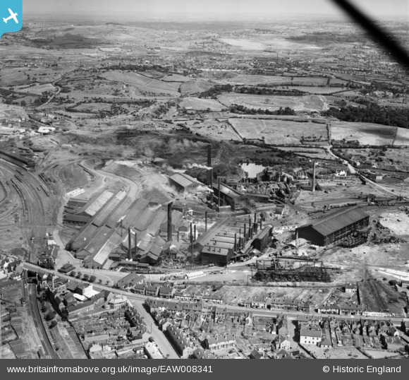
EAW008341 ENGLAND (1947). Round Oak Iron and Steel Works, Brierley Hill, 1947
© Copyright OpenStreetMap contributors and licensed by the OpenStreetMap Foundation. 2024. Cartography is licensed as CC BY-SA.
Nearby Images (19)
EAW008341

EAW008346

EAW008347

EAW008350

EAW008351

EAW008349

EAW008342

EAW008345

EAW008339

EAW008344

EAW008348

EAW038825

EAW038832

EAW038827

EAW008338

EAW008343

EAW038830

EAW038831

EAW038824

Details
| Title | [EAW008341] Round Oak Iron and Steel Works, Brierley Hill, 1947 |
| Reference | EAW008341 |
| Date | 20-July-1947 |
| Link | |
| Place name | BRIERLEY HILL |
| Parish | |
| District | |
| Country | ENGLAND |
| Easting / Northing | 392328, 287713 |
| Longitude / Latitude | -2.1129952114331, 52.486911987322 |
| National Grid Reference | SO923877 |
Pins
 tamworthhistoryinphotos |
Monday 2nd of October 2017 06:42:59 PM | |
 black country history hunter |
Wednesday 9th of September 2015 02:50:46 PM | |
Peter Turvey |
Sunday 23rd of November 2014 10:54:46 PM |


