
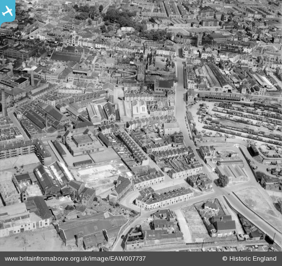
EAW007737 ENGLAND (1947). Houses and factories around the Hannah More School and Midland Road, Bristol, 1947
© Copyright OpenStreetMap contributors and licensed by the OpenStreetMap Foundation. 2024. Cartography is licensed as CC BY-SA.
Nearby Images (11)
EAW007737

EAW007735

EAW007736

EAW007732

EAW007733

EAW007731

EAW007738

EAW007734

EAW007739

EAW007740

EAW007741

Details
| Title | [EAW007737] Houses and factories around the Hannah More School and Midland Road, Bristol, 1947 |
| Reference | EAW007737 |
| Date | 22-June-1947 |
| Link | |
| Place name | BRISTOL |
| Parish | |
| District | |
| Country | ENGLAND |
| Easting / Northing | 359867, 172981 |
| Longitude / Latitude | -2.5776542118223, 51.453897545726 |
| National Grid Reference | ST599730 |
Pins
 Budget |
Friday 3rd of March 2023 07:12:54 PM | |
Budget |
Friday 3rd of March 2023 07:11:10 PM | |
Budget |
Friday 3rd of March 2023 07:10:16 PM | |
Budget |
Friday 3rd of March 2023 07:09:32 PM | |
ChurchCrawler |
Thursday 22nd of April 2021 02:39:41 PM | |
ChurchCrawler |
Thursday 22nd of April 2021 02:39:12 PM | |
Stuart |
Friday 3rd of January 2014 09:55:27 AM | |
Stuart |
Friday 3rd of January 2014 09:14:05 AM | |
Stuart |
Friday 3rd of January 2014 09:12:47 AM | |
Stuart |
Friday 3rd of January 2014 09:10:57 AM |


