
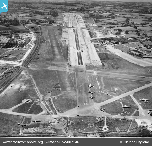
EAW007146 ENGLAND (1947). Bristol Filton Airport under construction, Filton, from the east, 1947
© Copyright OpenStreetMap contributors and licensed by the OpenStreetMap Foundation. 2024. Cartography is licensed as CC BY-SA.
Nearby Images (20)
EAW007146

EAW009941

EAW007137

EAW013919

EAW009943

EAW009942

EAW003554

EAW009940

EAW013915

EAW004176

EAW026947

EAW003553

EAW026948

EPW029358

EAW009939

EAW013918

EAW013916

EAW013920

EAW007135

EAW012430

Details
| Title | [EAW007146] Bristol Filton Airport under construction, Filton, from the east, 1947 |
| Reference | EAW007146 |
| Date | 11-June-1947 |
| Link | |
| Place name | FILTON |
| Parish | FILTON |
| District | |
| Country | ENGLAND |
| Easting / Northing | 360208, 180178 |
| Longitude / Latitude | -2.573557675931, 51.518637605942 |
| National Grid Reference | ST602802 |
Pins
 redmist |
Tuesday 17th of November 2020 09:41:27 PM | |
redmist |
Saturday 14th of November 2020 04:04:34 PM | |
redmist |
Saturday 14th of November 2020 04:03:58 PM | |
Kentishman |
Thursday 9th of May 2019 10:41:22 PM |


