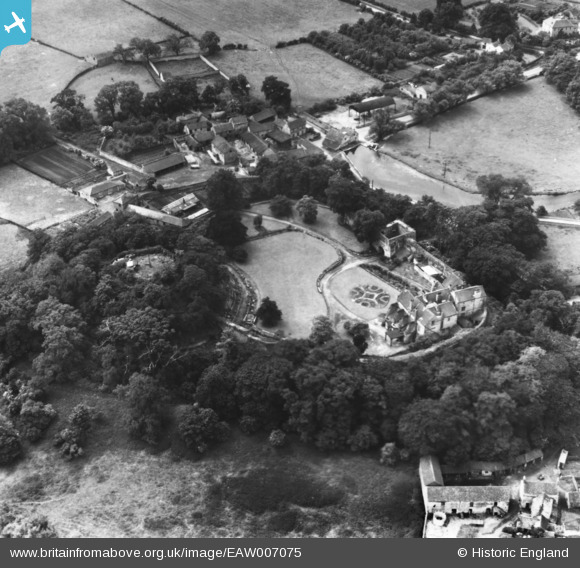
EAW007075 ENGLAND (1947). Tickhill Castle, Tickhill, 1947. This image has been produced from a print.
© Copyright OpenStreetMap contributors and licensed by the OpenStreetMap Foundation. 2024. Cartography is licensed as CC BY-SA.
Nearby Images (8)
Details
| Title | [EAW007075] Tickhill Castle, Tickhill, 1947. This image has been produced from a print. |
| Reference | EAW007075 |
| Date | 17-June-1947 |
| Link | |
| Place name | TICKHILL |
| Parish | TICKHILL |
| District | |
| Country | ENGLAND |
| Easting / Northing | 459314, 392842 |
| Longitude / Latitude | -1.1072070741411, 53.428768546988 |
| National Grid Reference | SK593928 |
Pins
Be the first to add a comment to this image!


![[EAW007075] Tickhill Castle, Tickhill, 1947. This image has been produced from a print.](http://britainfromabove.org.uk/sites/all/libraries/aerofilms-images/public/100x100/EAW/007/EAW007075.jpg)
![[EAW007077] Tickhill Castle, Tickhill, 1947](http://britainfromabove.org.uk/sites/all/libraries/aerofilms-images/public/100x100/EAW/007/EAW007077.jpg)
![[EPW012880] Tickhill Castle, Tickhill, 1925](http://britainfromabove.org.uk/sites/all/libraries/aerofilms-images/public/100x100/EPW/012/EPW012880.jpg)
![[EAW007073] Tickhill Castle, Tickhill, 1947. This image has been produced from a print.](http://britainfromabove.org.uk/sites/all/libraries/aerofilms-images/public/100x100/EAW/007/EAW007073.jpg)
![[EAW007076] Tickhill Castle, Tickhill, 1947](http://britainfromabove.org.uk/sites/all/libraries/aerofilms-images/public/100x100/EAW/007/EAW007076.jpg)
![[EAW007071] Tickhill Castle, Tickhill, 1947. This image has been produced from a print.](http://britainfromabove.org.uk/sites/all/libraries/aerofilms-images/public/100x100/EAW/007/EAW007071.jpg)
![[EAW007072] Tickhill Castle, Tickhill, 1947](http://britainfromabove.org.uk/sites/all/libraries/aerofilms-images/public/100x100/EAW/007/EAW007072.jpg)
![[EAW007074] Tickhill Castle, Tickhill, 1947. This image has been produced from a print.](http://britainfromabove.org.uk/sites/all/libraries/aerofilms-images/public/100x100/EAW/007/EAW007074.jpg)


