
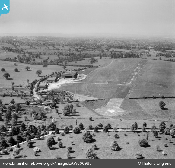
EAW006988 ENGLAND (1947). Elstree Aerodrome, Aldenham, from the north-east, 1947
© Copyright OpenStreetMap contributors and licensed by the OpenStreetMap Foundation. 2024. Cartography is licensed as CC BY-SA.
Nearby Images (18)
EAW006988

EAW027658
 in flight at Elstree Aerodrome, Aldenham, 1949")
EAW006987

EAW008424

EAW041155

EAW027497

EAW027665
 at Elstree Aerodrome, Aldenham, 1949")
EAW027500

EAW023639

EAW008427

EAW027657
 in flight over Elstree Aerodrome, Aldenham, 1949")
EAW027495

EAW023635

EAW023637

EAW023636

EAW041152

EAW023632

EAW041154

Details
| Title | [EAW006988] Elstree Aerodrome, Aldenham, from the north-east, 1947 |
| Reference | EAW006988 |
| Date | 16-June-1947 |
| Link | |
| Place name | ALDENHAM |
| Parish | ALDENHAM |
| District | |
| Country | ENGLAND |
| Easting / Northing | 516357, 196611 |
| Longitude / Latitude | -0.31773689131142, 51.655762486826 |
| National Grid Reference | TQ164966 |
Pins
 Sparky |
Tuesday 23rd of August 2022 06:19:17 PM | |
 Matt Aldred edob.mattaldred.com |
Wednesday 19th of August 2020 10:12:17 PM | |
MB |
Monday 11th of November 2013 11:58:09 PM |


