
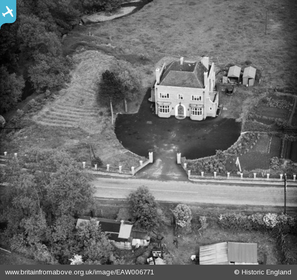
EAW006771 ENGLAND (1947). The Bridge Inn, Dorrington, 1947
© Copyright OpenStreetMap contributors and licensed by the OpenStreetMap Foundation. 2024. Cartography is licensed as CC BY-SA.
Nearby Images (3)
EAW006771

EAW006770

EAW006769

Details
| Title | [EAW006771] The Bridge Inn, Dorrington, 1947 |
| Reference | EAW006771 |
| Date | 28-May-1947 |
| Link | |
| Place name | DORRINGTON |
| Parish | CONDOVER |
| District | |
| Country | ENGLAND |
| Easting / Northing | 347535, 303772 |
| Longitude / Latitude | -2.7752213705683, 52.628814499817 |
| National Grid Reference | SJ475038 |
Pins
 Andrew Bennett |
Saturday 31st of May 2014 11:33:07 PM |
User Comment Contributions
 Bridge Inn, Dorrington, 27/05/2015 |
 Class31 |
Sunday 31st of May 2015 01:08:09 PM |
 Bridge Inn, Dorrington, 27/05/2015 |
Class31 |
Sunday 31st of May 2015 01:07:38 PM |
A Wrekin Ales establishment |
Andrew Bennett |
Saturday 31st of May 2014 11:22:36 PM |


