
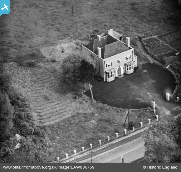
EAW006769 ENGLAND (1947). The Bridge Inn, Dorrington, 1947
© Copyright OpenStreetMap contributors and licensed by the OpenStreetMap Foundation. 2024. Cartography is licensed as CC BY-SA.
Nearby Images (3)
EAW006769

EAW006771

EAW006770

Details
| Title | [EAW006769] The Bridge Inn, Dorrington, 1947 |
| Reference | EAW006769 |
| Date | 28-May-1947 |
| Link | |
| Place name | DORRINGTON |
| Parish | CONDOVER |
| District | |
| Country | ENGLAND |
| Easting / Northing | 347550, 303770 |
| Longitude / Latitude | -2.7749994353981, 52.628797969777 |
| National Grid Reference | SJ476038 |
Pins
Be the first to add a comment to this image!
User Comment Contributions
 Bridge Inn, Dorrington, 27/05/2015 |
 Class31 |
Sunday 31st of May 2015 01:05:16 PM |
 Bridge Inn, Dorrington, 27/05/2015 |
Class31 |
Sunday 31st of May 2015 01:04:44 PM |
A Wrekin Ales establishment |
 Andrew Bennett |
Saturday 31st of May 2014 11:23:40 PM |


