
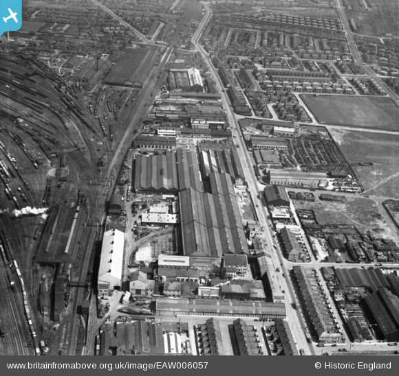
EAW006057 ENGLAND (1947). The C. A. Parsons & Co Heaton Works and environs, Heaton, 1947
© Copyright OpenStreetMap contributors and licensed by the OpenStreetMap Foundation. 2024. Cartography is licensed as CC BY-SA.
Nearby Images (25)
EAW006057

EAW006058

EAW006056

EPW042114

EAW005495

EAW005497

EPW042112

EPW059896

EAW005494

EPW042109

EAW005493

EPW042113

EAW022484

EPW054563

EPW042110

EAW005492

EAW005496

EAW022481

EAW022482

EPW042111

EPW059895

EAW022483

EAW022487

EAW022486

EAW022480

Details
| Title | [EAW006057] The C. A. Parsons & Co Heaton Works and environs, Heaton, 1947 |
| Reference | EAW006057 |
| Date | 21-May-1947 |
| Link | |
| Place name | HEATON |
| Parish | |
| District | |
| Country | ENGLAND |
| Easting / Northing | 427772, 565468 |
| Longitude / Latitude | -1.5659895210937, 54.982962368777 |
| National Grid Reference | NZ278655 |
Pins
 John Wass |
Tuesday 15th of July 2014 08:44:47 PM | |
Geoff |
Saturday 7th of December 2013 07:32:30 PM | |
Geoff |
Saturday 7th of December 2013 07:31:34 PM | |
Geoff |
Monday 11th of November 2013 11:08:23 PM |


