
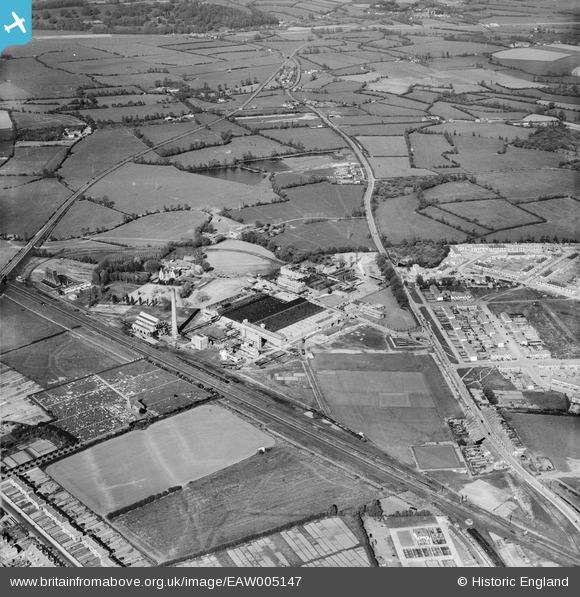
EAW005147 ENGLAND (1947). The British Cellophane Ltd Factory and the surrounding area, Bridgwater, 1947
© Copyright OpenStreetMap contributors and licensed by the OpenStreetMap Foundation. 2024. Cartography is licensed as CC BY-SA.
Nearby Images (21)
EAW005147

EAW005152

EAW005143

EAW005154

EAW005142

EAW005155

EAW051133

EAW051129

EAW005146

EAW005149

EAW005156

EAW051131

EAW051134

EAW005158

EAW005150

EAW051130

EAW005151

EAW005157

EAW051128

EAW005145

EAW051127

Details
| Title | [EAW005147] The British Cellophane Ltd Factory and the surrounding area, Bridgwater, 1947 |
| Reference | EAW005147 |
| Date | 7-September-1947 |
| Link | |
| Place name | BRIDGWATER |
| Parish | BRIDGWATER |
| District | |
| Country | ENGLAND |
| Easting / Northing | 331185, 138263 |
| Longitude / Latitude | -2.9837412537329, 51.138970806496 |
| National Grid Reference | ST312383 |
Pins
 Sparky |
Sunday 6th of August 2017 09:02:12 PM | |
Sparky |
Sunday 6th of August 2017 09:00:31 PM | |
Sparky |
Sunday 6th of August 2017 08:59:45 PM | |
Sparky |
Sunday 6th of August 2017 08:58:42 PM | |
Sparky |
Sunday 6th of August 2017 08:57:49 PM | |
Sparky |
Sunday 6th of August 2017 08:57:18 PM | |
totoro |
Thursday 3rd of October 2013 10:57:33 PM | |
totoro |
Thursday 3rd of October 2013 10:57:12 PM | |
totoro |
Thursday 3rd of October 2013 10:55:28 PM | |
totoro |
Thursday 3rd of October 2013 10:55:02 PM | |
totoro |
Thursday 3rd of October 2013 10:54:45 PM | |
totoro |
Thursday 3rd of October 2013 10:53:59 PM |


