
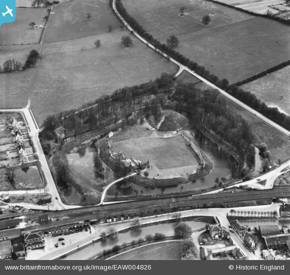
EAW004826 ENGLAND (1947). Berkhamsted Castle, Berkhamstead, 1947. This image has been produced from a print.
© Copyright OpenStreetMap contributors and licensed by the OpenStreetMap Foundation. 2024. Cartography is licensed as CC BY-SA.
Nearby Images (23)
EAW004826

EAW049276

EAW004824

EAW014224

EAW004825

EAW014225

EAW049278

EAW048760

EAW014228

EAW004823

EAW049279

EAW053211

EAW014223

EAW014226

EAW014222

EAW053212A

EAW053209

EAW053210

EAW014227

EAW049277

EAW048762

EAW048763

EAW048761

Details
| Title | [EAW004826] Berkhamsted Castle, Berkhamstead, 1947. This image has been produced from a print. |
| Reference | EAW004826 |
| Date | 29-April-1947 |
| Link | |
| Place name | BERKHAMSTED |
| Parish | BERKHAMSTED |
| District | |
| Country | ENGLAND |
| Easting / Northing | 499543, 208264 |
| Longitude / Latitude | -0.55741105150053, 51.763745143146 |
| National Grid Reference | SP995083 |
Pins
 Sparky |
Saturday 14th of October 2017 09:58:08 PM |


