
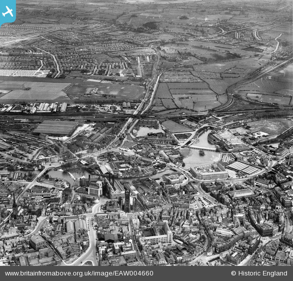
EAW004660 ENGLAND (1947). The city centre, Derby, from the west, 1947
© Copyright OpenStreetMap contributors and licensed by the OpenStreetMap Foundation. 2024. Cartography is licensed as CC BY-SA.
Nearby Images (20)
EAW004660

EAW004663

EPW021120

EPW021121

EPW021123

EAW004661

EPW021122

EPW021119

EPW005817

EAW004658

EAW004662

EPW055028

EAW002468

EAW015423

EPW055021

EAW002466

EAW002467

EPW005816

EPW055025

EPW055026

Details
| Title | [EAW004660] The city centre, Derby, from the west, 1947 |
| Reference | EAW004660 |
| Date | 22-April-1947 |
| Link | |
| Place name | DERBY |
| Parish | |
| District | |
| Country | ENGLAND |
| Easting / Northing | 435249, 336437 |
| Longitude / Latitude | -1.4756300834946, 52.923870065601 |
| National Grid Reference | SK352364 |
Pins
 Alfonso Keller |
Thursday 7th of December 2023 12:02:30 PM | |
Alfonso Keller |
Thursday 7th of December 2023 11:54:10 AM | |
RobF |
Tuesday 22nd of March 2022 10:26:33 AM | |
RobF |
Tuesday 22nd of March 2022 10:26:04 AM | |
gBr |
Monday 30th of January 2017 01:25:40 PM | |
gBr |
Monday 30th of January 2017 01:22:06 PM | |
gBr |
Monday 30th of January 2017 01:15:34 PM | |
gBr |
Monday 30th of January 2017 01:09:42 PM | |
gBr |
Monday 30th of January 2017 01:07:32 PM | |
gBr |
Monday 30th of January 2017 01:06:15 PM | |
gBr |
Monday 30th of January 2017 01:05:15 PM |


