
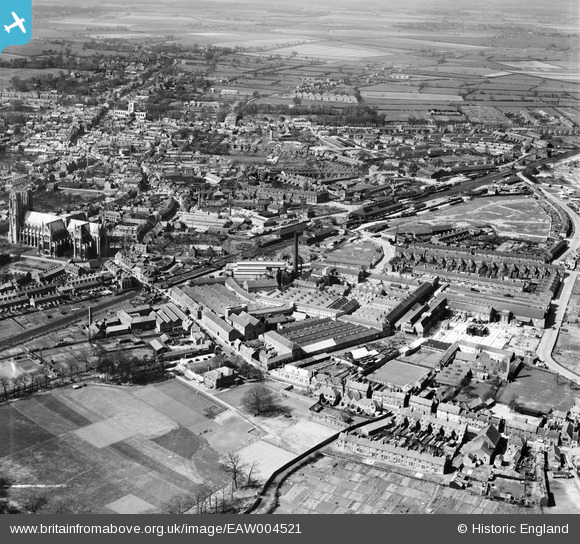
EAW004521 ENGLAND (1947). Hodgson's Tannery and Glue Works and the town, Beverley, from the south-east, 1947
© Copyright OpenStreetMap contributors and licensed by the OpenStreetMap Foundation. 2024. Cartography is licensed as CC BY-SA.
Nearby Images (24)
EAW004521

EAW035021

EAW035024

EAW035026

EAW035023

EAW035025

EAW004522

EAW004526

EAW035022

EAW035020

EAW035027

EPW023163

EAW004517

EAW035029

EAW035028

EPW023162

EAW004516

EAW035030

EPW023169

EPW023164

EPW023165

EAW004519

EAW004520

EPW023167

Details
| Title | [EAW004521] Hodgson's Tannery and Glue Works and the town, Beverley, from the south-east, 1947 |
| Reference | EAW004521 |
| Date | 16-April-1947 |
| Link | |
| Place name | BEVERLEY |
| Parish | BEVERLEY |
| District | |
| Country | ENGLAND |
| Easting / Northing | 504116, 439167 |
| Longitude / Latitude | -0.41756363678535, 53.83809661736 |
| National Grid Reference | TA041392 |
Pins
 redmist |
Sunday 4th of October 2020 08:24:39 PM | |
Mark |
Thursday 5th of March 2020 07:32:51 AM | |
 |
John Wass |
Wednesday 16th of September 2015 10:00:55 PM |
Well spotted! |
Isleworth1961 |
Thursday 13th of October 2016 03:11:01 PM |


