
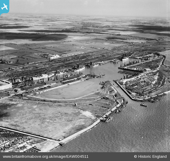
EAW004511 ENGLAND (1947). King George Dock and environs, Kingston upon Hull, from the south-west, 1947
© Copyright OpenStreetMap contributors and licensed by the OpenStreetMap Foundation. 2024. Cartography is licensed as CC BY-SA.
Nearby Images (6)
EAW004511

EAW693178

EPW036424

EPW036423

EAW004510

EAW004512

Details
| Title | [EAW004511] King George Dock and environs, Kingston upon Hull, from the south-west, 1947 |
| Reference | EAW004511 |
| Date | 16-April-1947 |
| Link | |
| Place name | KINGSTON UPON HULL |
| Parish | |
| District | |
| Country | ENGLAND |
| Easting / Northing | 513750, 428618 |
| Longitude / Latitude | -0.27510245721873, 53.741294477538 |
| National Grid Reference | TA138286 |


