
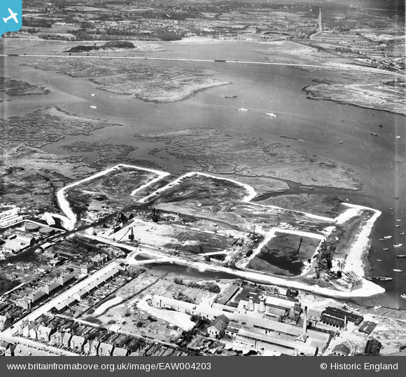
EAW004203 ENGLAND (1947). Land reclamation at the site of Hamworthy Power Station, Poole, 1947
© Copyright OpenStreetMap contributors and licensed by the OpenStreetMap Foundation. 2024. Cartography is licensed as CC BY-SA.
Nearby Images (16)
EAW004203

EAW004202

EAW019945

EAW004204

EAW004209

EAW019955

EAW004198

EAW004208

EAW004206

EAW004201

EAW019953

EAW019950

EAW019948

EAW019947

EAW004207

EAW019952

Details
| Title | [EAW004203] Land reclamation at the site of Hamworthy Power Station, Poole, 1947 |
| Reference | EAW004203 |
| Date | 10-April-1947 |
| Link | |
| Place name | POOLE |
| Parish | |
| District | |
| Country | ENGLAND |
| Easting / Northing | 400301, 90874 |
| Longitude / Latitude | -1.9957358763774, 50.716920270252 |
| National Grid Reference | SZ003909 |
Pins
 redmist |
Sunday 9th of August 2020 11:13:30 AM | |
MikeMist |
Friday 20th of September 2019 07:01:42 PM | |
MikeMist |
Friday 20th of September 2019 06:57:59 PM |


