
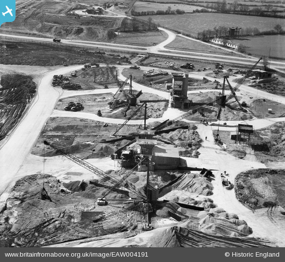
EAW004191 ENGLAND (1947). Cranes handling aggregates during building works at Bristol Filton Airport, Catbrain, 1947
© Copyright OpenStreetMap contributors and licensed by the OpenStreetMap Foundation. 2024. Cartography is licensed as CC BY-SA.
Nearby Images (20)
EAW004191

EAW007130

EAW007148

EAW004188

EAW007134

EAW007141

EAW004189

EAW007129

EAW007139

EAW007132

EAW007147

EAW007150

EAW007149

EAW004193

EAW004192

EAW004185

EAW003552

EAW003551

EAW003558

EAW003550

Details
| Title | [EAW004191] Cranes handling aggregates during building works at Bristol Filton Airport, Catbrain, 1947 |
| Reference | EAW004191 |
| Date | 10-April-1947 |
| Link | |
| Place name | CATBRAIN |
| Parish | ALMONDSBURY |
| District | |
| Country | ENGLAND |
| Easting / Northing | 359265, 180565 |
| Longitude / Latitude | -2.5871939707212, 51.522050273893 |
| National Grid Reference | ST593806 |
Pins
 redmist |
Saturday 14th of November 2020 02:40:32 PM |


