
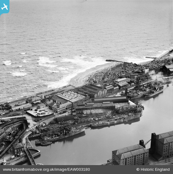
EAW003180 ENGLAND (1946). The North Eastern Marine Engineering Company Works, Sunderland, 1946
© Copyright OpenStreetMap contributors and licensed by the OpenStreetMap Foundation. 2024. Cartography is licensed as CC BY-SA.
Nearby Images (18)
EAW003180

EAW003184

EAW003177

EAW003181

EAW003175

EAW003171

EAW003178

EAW003179

EPW020539

EPW020533

EAW003172

EAW003176

EAW003174

EAW003173

EAW003183

EPW051128

EAW003170

EAW003182

Details
| Title | [EAW003180] The North Eastern Marine Engineering Company Works, Sunderland, 1946 |
| Reference | EAW003180 |
| Date | 23-October-1946 |
| Link | |
| Place name | SUNDERLAND |
| Parish | |
| District | |
| Country | ENGLAND |
| Easting / Northing | 441299, 557535 |
| Longitude / Latitude | -1.3557481935243, 54.910732815047 |
| National Grid Reference | NZ413575 |
Pins
 redmist |
Saturday 26th of September 2020 01:48:34 PM | |
redmist |
Saturday 26th of September 2020 01:48:10 PM | |
redmist |
Monday 18th of March 2019 07:01:17 PM | |
redmist |
Monday 18th of March 2019 06:58:23 PM | |
ken |
Saturday 18th of July 2015 07:47:37 PM |


