
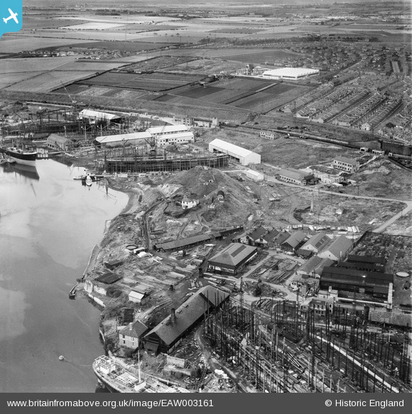
EAW003161 ENGLAND (1946). The Richardsons, Westgarth and Co Shipbuilding Yard (G. Clark Ltd), Glasshouse Hill and the Castletown Shipbuilding Yard, Sunderland, 1946
© Copyright OpenStreetMap contributors and licensed by the OpenStreetMap Foundation. 2024. Cartography is licensed as CC BY-SA.
Nearby Images (13)
EAW003161
, Glasshouse Hill and the Castletown Shipbuilding Yard, Sunderland, 1946")
EAW003158
 and the surrounding residential area, Sunderland, from the south-west, 1946")
EAW003159
, Sunderland, 1946")
EPW006529

EAW003160
 and the Pallion Shipbuilding Yard, Sunderland, 1946")
EPW006526

EAW003156
 alongside Queen Alexandra Bridge, Sunderland, 1946")
EAW001035

EAW003152
, Queen Alexandra Bridge and the surrounding residential area, Sunderland, 1946")
EPW006528

EAW003157
 and the Pallion Shipbuilding Yard, Sunderland, 1946")
EAW001034

EAW003151
 alongside Queen Alexandra Bridge, Sunderland, 1946")
Details
| Title | [EAW003161] The Richardsons, Westgarth and Co Shipbuilding Yard (G. Clark Ltd), Glasshouse Hill and the Castletown Shipbuilding Yard, Sunderland, 1946 |
| Reference | EAW003161 |
| Date | 23-October-1946 |
| Link | |
| Place name | SUNDERLAND |
| Parish | |
| District | |
| Country | ENGLAND |
| Easting / Northing | 437892, 558105 |
| Longitude / Latitude | -1.4088179900411, 54.916125431433 |
| National Grid Reference | NZ379581 |
Pins
 redmist |
Saturday 26th of September 2020 11:28:03 AM | |
redmist |
Saturday 26th of September 2020 11:27:38 AM | |
redmist |
Saturday 26th of September 2020 11:24:57 AM | |
redmist |
Saturday 26th of September 2020 11:24:20 AM | |
redmist |
Saturday 26th of September 2020 11:22:40 AM | |
redmist |
Saturday 26th of September 2020 11:22:11 AM |


