
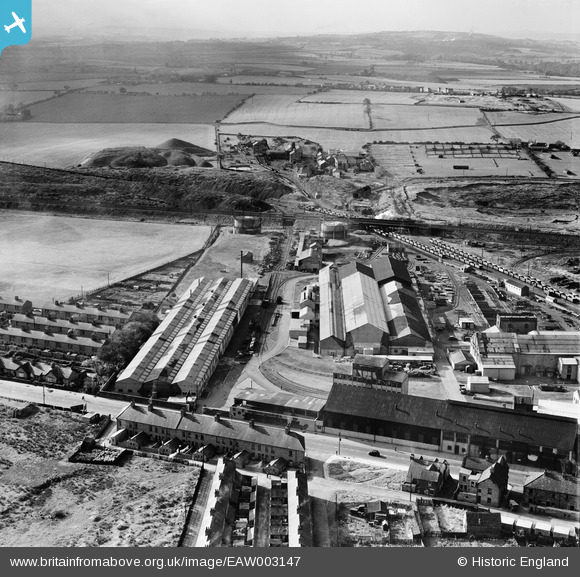
EAW003147 ENGLAND (1946). The Birtley Iron Co Ltd Works and Ouston Colliery, Birtley, from the north-east, 1946
© Copyright OpenStreetMap contributors and licensed by the OpenStreetMap Foundation. 2024. Cartography is licensed as CC BY-SA.
Nearby Images (11)
EAW003147

EAW003144

EAW003149

EAW003139

EAW003146

EAW003140

EAW003145

EAW003141

EAW003143

EAW003148

EAW003138

Details
| Title | [EAW003147] The Birtley Iron Co Ltd Works and Ouston Colliery, Birtley, from the north-east, 1946 |
| Reference | EAW003147 |
| Date | 23-October-1946 |
| Link | |
| Place name | BIRTLEY |
| Parish | |
| District | |
| Country | ENGLAND |
| Easting / Northing | 427243, 555116 |
| Longitude / Latitude | -1.5752379420215, 54.889957478253 |
| National Grid Reference | NZ272551 |
Pins
 redmist |
Thursday 31st of October 2019 10:53:44 PM | |
redmist |
Thursday 31st of October 2019 10:53:19 PM | |
redmist |
Thursday 31st of October 2019 10:52:46 PM | |
redmist |
Thursday 31st of October 2019 10:52:01 PM | |
Sparky |
Friday 15th of September 2017 09:30:09 AM | |
Sparky |
Wednesday 26th of July 2017 11:14:37 AM | |
Sparky |
Wednesday 26th of July 2017 11:14:37 AM | |
Stuart |
Tuesday 10th of September 2013 02:37:32 PM | |
Stuart |
Tuesday 10th of September 2013 02:36:04 PM | |
Stuart |
Tuesday 10th of September 2013 02:34:12 PM | |
Stuart |
Tuesday 10th of September 2013 02:31:00 PM | |
Stuart |
Tuesday 10th of September 2013 02:30:24 PM | |
Stuart |
Tuesday 10th of September 2013 02:29:45 PM |


