
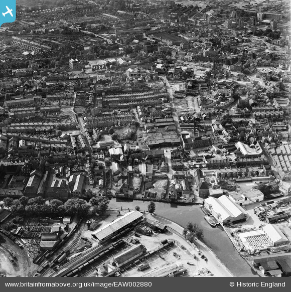
EAW002880 ENGLAND (1946). The Morgans Old Brewery off King Street and the surrounding area, Norwich, 1946
© Copyright OpenStreetMap contributors and licensed by the OpenStreetMap Foundation. 2024. Cartography is licensed as CC BY-SA.
Nearby Images (9)
EAW002880

EAW002884

EAW002885

EAW002883

EAW002881

EAW002878

EAW002882

EAW002879

EPW001970

Details
| Title | [EAW002880] The Morgans Old Brewery off King Street and the surrounding area, Norwich, 1946 |
| Reference | EAW002880 |
| Date | 1-October-1946 |
| Link | |
| Place name | NORWICH |
| Parish | |
| District | |
| Country | ENGLAND |
| Easting / Northing | 623496, 308152 |
| Longitude / Latitude | 1.3025138543728, 52.624687695231 |
| National Grid Reference | TG235082 |
Pins
 Ginger |
Tuesday 29th of October 2019 07:03:05 PM | |
Chris Lambert |
Sunday 26th of April 2015 04:13:26 PM | |
Chris Lambert |
Sunday 19th of April 2015 03:12:06 PM | |
Chris Lambert |
Sunday 19th of April 2015 03:09:41 PM | |
Chris Lambert |
Sunday 19th of April 2015 03:08:46 PM | |
Chris Lambert |
Sunday 19th of April 2015 03:07:59 PM | |
Chris Lambert |
Sunday 19th of April 2015 03:06:51 PM | |
Chris Lambert |
Sunday 19th of April 2015 03:05:14 PM | |
Chris Lambert |
Sunday 19th of April 2015 03:04:30 PM | |
Chris Lambert |
Sunday 19th of April 2015 03:03:38 PM | |
Chris Lambert |
Sunday 19th of April 2015 03:02:05 PM | |
Chris Lambert |
Sunday 19th of April 2015 03:01:22 PM |


