
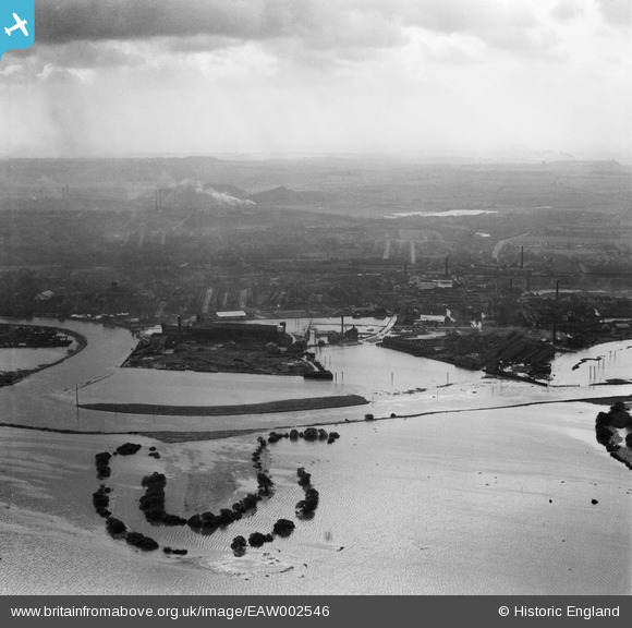
EAW002546 ENGLAND (1946). Flooded fields around an oxbow lake to the west of the confluence of the Rivers Aire and Calder, Castleford, from the north, 1946
© Copyright OpenStreetMap contributors and licensed by the OpenStreetMap Foundation. 2024. Cartography is licensed as CC BY-SA.
Nearby Images (2)
EAW002546

EAW002543

Details
| Title | [EAW002546] Flooded fields around an oxbow lake to the west of the confluence of the Rivers Aire and Calder, Castleford, from the north, 1946 |
| Reference | EAW002546 |
| Date | 21-September-1946 |
| Link | |
| Place name | CASTLEFORD |
| Parish | |
| District | |
| Country | ENGLAND |
| Easting / Northing | 442132, 426122 |
| Longitude / Latitude | -1.3613158635331, 53.729568320923 |
| National Grid Reference | SE421261 |
Pins
User Comment Contributions
Difficult to pinpoint landmarks through the soot and the grime. All the industries of Castleford, Collieries, Chemical Works, Glassworks. Brickworks, sweet manufacture and Potteries all now resigned to the history books. |
 Derekdye |
Sunday 17th of November 2013 09:15:45 PM |


