
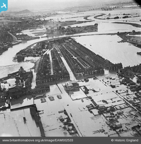
EAW002533 ENGLAND (1946). A large area of flooding centred upon Hunt Street and Lock Lane, Castleford, 1946
© Copyright OpenStreetMap contributors and licensed by the OpenStreetMap Foundation. 2024. Cartography is licensed as CC BY-SA.
Nearby Images (7)
EAW002533

EAW002538A

EAW002544

EAW002534

EAW002542

EAW002540

EAW002551

Details
| Title | [EAW002533] A large area of flooding centred upon Hunt Street and Lock Lane, Castleford, 1946 |
| Reference | EAW002533 |
| Date | 21-September-1946 |
| Link | |
| Place name | CASTLEFORD |
| Parish | |
| District | |
| Country | ENGLAND |
| Easting / Northing | 442848, 426136 |
| Longitude / Latitude | -1.3504607535202, 53.729635826747 |
| National Grid Reference | SE428261 |
Pins
 Steve Glover |
Saturday 20th of January 2018 06:17:11 PM | |
Steve Glover |
Saturday 20th of January 2018 06:16:05 PM | |
Steve Glover |
Saturday 20th of January 2018 06:15:44 PM | |
 Derekdye |
Sunday 17th of November 2013 08:51:07 PM | |
Derekdye |
Sunday 17th of November 2013 08:48:43 PM |


