
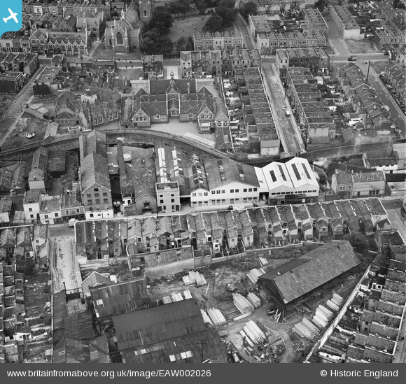
EAW002026 ENGLAND (1946). John Somers & Sons Packing Case Factory, Newfoundland Road Schools and timber yard off Colston Place, Bristol, 1946
© Copyright OpenStreetMap contributors and licensed by the OpenStreetMap Foundation. 2024. Cartography is licensed as CC BY-SA.
Nearby Images (10)
EAW002026

EAW002024

EAW002027

EAW002023

EAW002025

EAW002029

EAW002032

EAW002030

EAW002028

EAW002031

Details
| Title | [EAW002026] John Somers & Sons Packing Case Factory, Newfoundland Road Schools and timber yard off Colston Place, Bristol, 1946 |
| Reference | EAW002026 |
| Date | 29-July-1946 |
| Link | |
| Place name | BRISTOL |
| Parish | |
| District | |
| Country | ENGLAND |
| Easting / Northing | 360104, 174043 |
| Longitude / Latitude | -2.5743629886264, 51.46346393073 |
| National Grid Reference | ST601740 |
Pins
 Sparky |
Sunday 6th of August 2017 09:35:33 AM | |
Sparky |
Sunday 6th of August 2017 09:35:08 AM | |
Sparky |
Sunday 6th of August 2017 09:34:09 AM | |
MB |
Wednesday 31st of August 2016 10:09:11 AM | |
MB |
Wednesday 31st of August 2016 10:07:27 AM | |
Mikeygeee |
Wednesday 16th of July 2014 04:43:01 PM | |
 Class31 |
Monday 2nd of September 2013 02:25:20 PM |


