
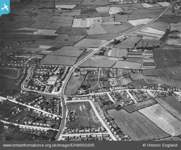
EAW001605 ENGLAND (1946). Morton Bridge, Saughall Massie, 1946. This image has been produced from a print.
© Copyright OpenStreetMap contributors and licensed by the OpenStreetMap Foundation. 2024. Cartography is licensed as CC BY-SA.
Nearby Images (2)
EAW001605

EAW001294

Details
| Title | [EAW001605] Morton Bridge, Saughall Massie, 1946. This image has been produced from a print. |
| Reference | EAW001605 |
| Date | 11-July-1946 |
| Link | |
| Place name | SAUGHALL MASSIE |
| Parish | |
| District | |
| Country | ENGLAND |
| Easting / Northing | 325202, 389499 |
| Longitude / Latitude | -3.1250202442998, 53.396753012255 |
| National Grid Reference | SJ252895 |
Pins
 Runnybabbit |
Tuesday 13th of February 2018 09:18:55 PM | |
Sparky |
Thursday 14th of September 2017 08:34:18 AM | |
gagzzy |
Saturday 20th of September 2014 08:33:05 AM |


