
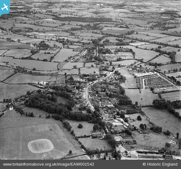
EAW001542 ENGLAND (1946). The town, Chipping Ongar, from the north, 1946
© Copyright OpenStreetMap contributors and licensed by the OpenStreetMap Foundation. 2024. Cartography is licensed as CC BY-SA.
Nearby Images (6)
EAW001542

EAW037034

EAW001541

EAW037033

EAW001543

EAW037032

Details
| Title | [EAW001542] The town, Chipping Ongar, from the north, 1946 |
| Reference | EAW001542 |
| Date | 5-July-1946 |
| Link | |
| Place name | CHIPPING ONGAR |
| Parish | ONGAR |
| District | |
| Country | ENGLAND |
| Easting / Northing | 555248, 203211 |
| Longitude / Latitude | 0.24706834693084, 51.705669862289 |
| National Grid Reference | TL552032 |


