
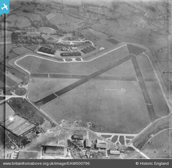
EAW000796 ENGLAND (1946). RAF Ringway, Catle Hill, 1946
© Copyright OpenStreetMap contributors and licensed by the OpenStreetMap Foundation. 2024. Cartography is licensed as CC BY-SA.
Nearby Images (5)
EAW000796

EAW000792

EAW000793

EAW000797

EPW017413

Details
| Title | [EAW000796] RAF Ringway, Catle Hill, 1946 |
| Reference | EAW000796 |
| Date | 12-May-1946 |
| Link | |
| Place name | CASTLE HILL |
| Parish | RINGWAY |
| District | |
| Country | ENGLAND |
| Easting / Northing | 381906, 384292 |
| Longitude / Latitude | -2.2718766689224, 53.354934109408 |
| National Grid Reference | SJ819843 |
Pins
Be the first to add a comment to this image!


