
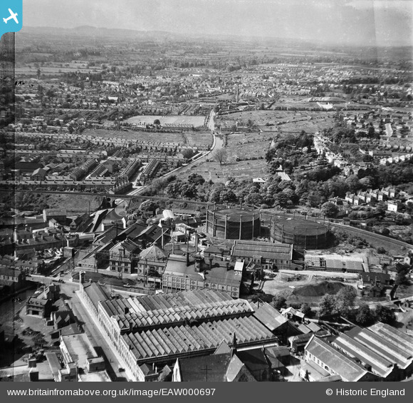
EAW000697 ENGLAND (1946). The Gaslight Co Gas Works, Worcester, from the south-east, 1946. This image has been produced from a damaged negative.
© Copyright OpenStreetMap contributors and licensed by the OpenStreetMap Foundation. 2024. Cartography is licensed as CC BY-SA.
Nearby Images (15)
EAW000697

EPW044987

EAW000695

EPW001299

EPW044989

EPW044990

EPW044986

EAW000693

EPW044988

EAW000691

EAW000694

EPW044985

EPW044991

EAW000692

EPW005415

Details
| Title | [EAW000697] The Gaslight Co Gas Works, Worcester, from the south-east, 1946. This image has been produced from a damaged negative. |
| Reference | EAW000697 |
| Date | 10-May-1946 |
| Link | |
| Place name | WORCESTER |
| Parish | |
| District | |
| Country | ENGLAND |
| Easting / Northing | 385558, 255320 |
| Longitude / Latitude | -2.2113119919111, 52.195524184119 |
| National Grid Reference | SO856553 |
Pins
 Sparky |
Tuesday 26th of September 2017 12:40:46 PM | |
Sparky |
Wednesday 2nd of August 2017 09:08:46 PM | |
 Class31 |
Friday 20th of May 2016 08:21:51 PM | |
Class31 |
Friday 20th of May 2016 08:18:05 PM | |
Peter Price |
Tuesday 31st of December 2013 04:03:54 PM | |
Peter Price |
Tuesday 31st of December 2013 04:02:54 PM | |
The club house stands in the edge of the field of allotments so this confirms that this was a playing field before the war. |
Peter Price |
Tuesday 31st of December 2013 04:46:25 PM |
Peter Price |
Tuesday 31st of December 2013 03:50:46 PM |


