
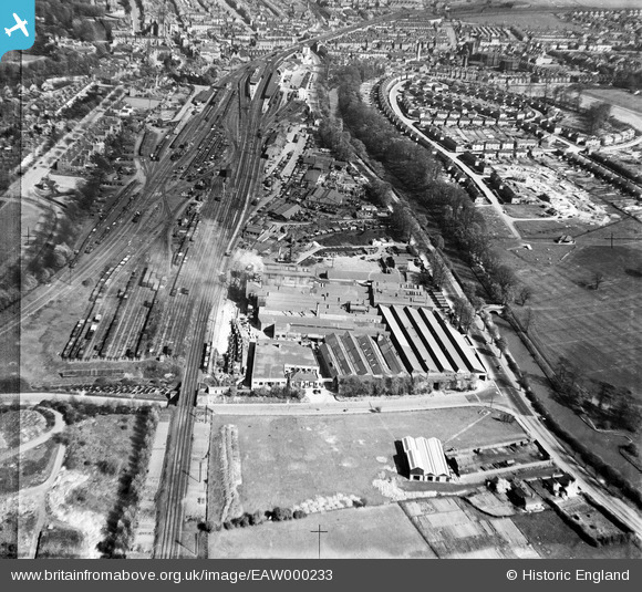
EAW000233 ENGLAND (1946). The Ford Motor Company factory on Prince's Drive and environs, Royal Leamington Spa, 1946
© Copyright OpenStreetMap contributors and licensed by the OpenStreetMap Foundation. 2024. Cartography is licensed as CC BY-SA.
Nearby Images (19)
EAW000233

EAW000238

EAW000232

EAW040094

EAW040096

EAW000236

EPW053196

EPW053199

EPW053195

EAW000237

EPW053200

EPW053197

EAW040095

EAW000149
 Foundry off Prince's Drive, Royal Leamington Spa, 1946")
EAW000234

EPW053198

EAW000235

EAW000150
 Foundry off Prince's Drive, Royal Leamington Spa, 1946")
EPW019737

Details
| Title | [EAW000233] The Ford Motor Company factory on Prince's Drive and environs, Royal Leamington Spa, 1946 |
| Reference | EAW000233 |
| Date | 15-April-1946 |
| Link | |
| Place name | ROYAL LEAMINGTON SPA |
| Parish | ROYAL LEAMINGTON SPA |
| District | |
| Country | ENGLAND |
| Easting / Northing | 431125, 265216 |
| Longitude / Latitude | -1.5436806764833, 52.283810442199 |
| National Grid Reference | SP311652 |
Pins
 redmist |
Sunday 6th of November 2022 08:39:47 PM |


