
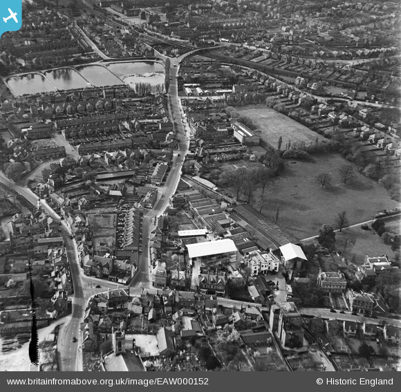
EAW000152 ENGLAND (1946). Station Road and environs, Hampton, 1946
© Copyright OpenStreetMap contributors and licensed by the OpenStreetMap Foundation. 2024. Cartography is licensed as CC BY-SA.
Nearby Images (8)
EAW000152

EAW000157

EAW000156

EAW000154

EAW000155

EAW000153

EPW022851

EPW006797

Details
| Title | [EAW000152] Station Road and environs, Hampton, 1946 |
| Reference | EAW000152 |
| Date | 11-April-1946 |
| Link | |
| Place name | HAMPTON |
| Parish | |
| District | |
| Country | ENGLAND |
| Easting / Northing | 513842, 169643 |
| Longitude / Latitude | -0.36280383304977, 51.413868723019 |
| National Grid Reference | TQ138696 |
Pins
 Alfonso Keller |
Wednesday 6th of December 2023 02:53:13 PM | |
Sparky |
Thursday 31st of August 2017 06:12:31 PM | |
Pip |
Saturday 4th of January 2014 01:22:05 PM | |
Pip |
Saturday 4th of January 2014 01:21:22 PM | |
Pip |
Saturday 4th of January 2014 01:19:39 PM | |
Pip |
Friday 3rd of January 2014 12:39:06 AM | |
Pip |
Wednesday 1st of January 2014 10:58:22 PM | |
Pip |
Wednesday 1st of January 2014 10:55:37 PM | |
Pip |
Wednesday 1st of January 2014 10:53:47 PM | |
Pip |
Wednesday 1st of January 2014 10:52:17 PM | |
Pip |
Wednesday 1st of January 2014 10:51:56 PM | |
Pip |
Wednesday 1st of January 2014 10:51:33 PM | |
Pip |
Wednesday 1st of January 2014 02:14:53 AM |


