
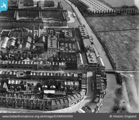
EAW000090 ENGLAND (1946). The A. H. Hunt Ltd Capacitor Works alongside the River Wandle, Earlsfield, 1946
© Copyright OpenStreetMap contributors and licensed by the OpenStreetMap Foundation. 2024. Cartography is licensed as CC BY-SA.
Nearby Images (21)
EAW000090

EPW031958

EAW000089

EAW000092

EAW000094

EPW031956

EAW000091

EAW000093

EPW031959

EPW031954

EPW031957

EPW031953

EPW031955

EPW060337

EPW060339

EPW058948

EPW060338

EPW058949

EPW060341

EPW060340

EPW060336

Details
| Title | [EAW000090] The A. H. Hunt Ltd Capacitor Works alongside the River Wandle, Earlsfield, 1946 |
| Reference | EAW000090 |
| Date | 1-April-1946 |
| Link | |
| Place name | EARLSFIELD |
| Parish | |
| District | |
| Country | ENGLAND |
| Easting / Northing | 525694, 173526 |
| Longitude / Latitude | -0.19106542511252, 51.446265636226 |
| National Grid Reference | TQ257735 |


