
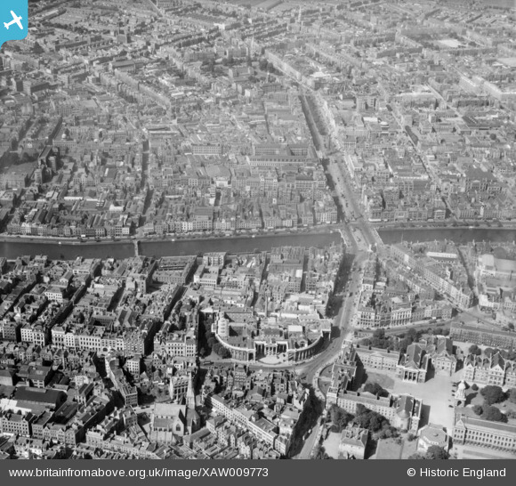
XAW009773 IRELAND (1947). Bank of Ireland and O'Connell Street , Dublin, Dublin, Ireland, 1947. Oblique aerial photograph taken facing North.
© Hawlfraint cyfranwyr OpenStreetMap a thrwyddedwyd gan yr OpenStreetMap Foundation. 2024. Trwyddedir y gartograffeg fel CC BY-SA.
Delweddau cyfagos (5)
XAW009773

XAW009777

XAW009774

XPW042323

XAW044977

Manylion
| Pennawd | [XAW009773] Bank of Ireland and O'Connell Street , Dublin, Dublin, Ireland, 1947. Oblique aerial photograph taken facing North. |
| Cyfeirnod | XAW009773 |
| Dyddiad | 1-September-1947 |
| Dolen | |
| Enw lle | DUBLIN |
| Plwyf | IRELAND |
| Ardal | |
| Gwlad | IRELAND |
| Dwyreiniad / Gogleddiad | 116511, 391828 |
| Hydred / Lledred | -6.260906, 53.347153 |
| Cyfeirnod Grid Cenedlaethol |
Pinnau
 Zero |
Tuesday 11th of July 2023 01:48:04 AM | |
Zero |
Tuesday 11th of July 2023 01:44:24 AM | |
HeritageDublin |
Friday 17th of October 2014 10:05:28 AM | |
HeritageDublin |
Friday 17th of October 2014 08:29:59 AM |


