
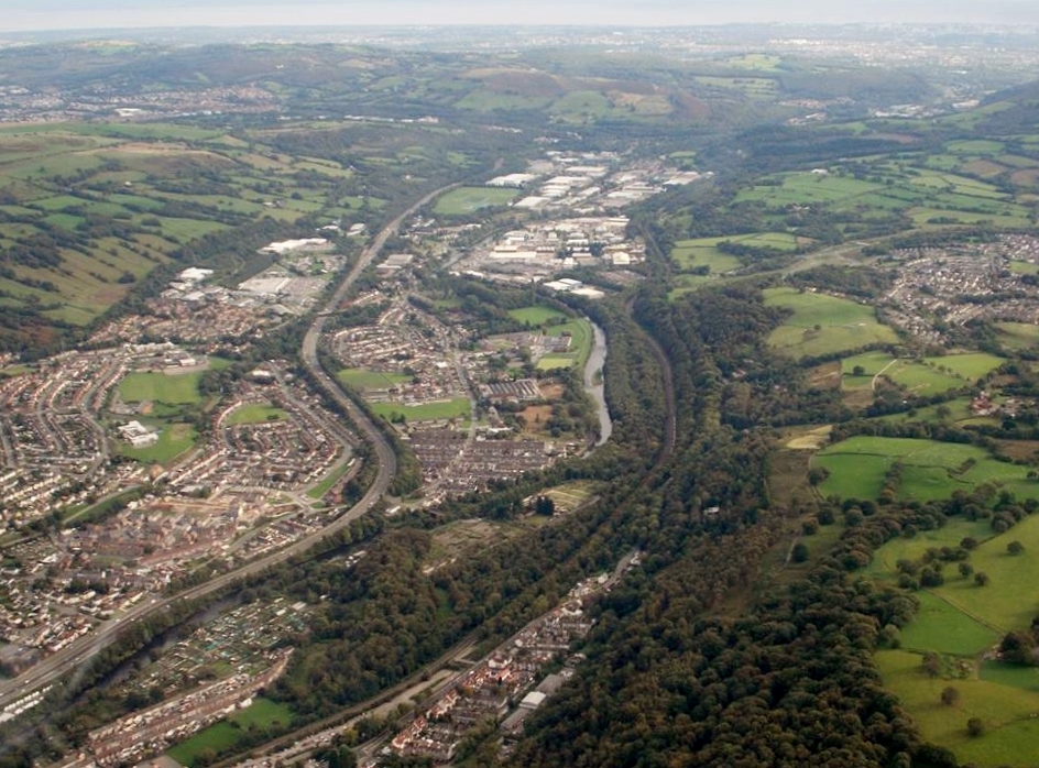
WPW056435 WALES (1938). View of the Treforest trading estate under construction, oblique aerial view. 5"x4" black and white glass plate negative.

© Hawlfraint cyfranwyr OpenStreetMap a thrwyddedwyd gan yr OpenStreetMap Foundation. 2024. Trwyddedir y gartograffeg fel CC BY-SA.
Delweddau cyfagos (38)
WAW018006

WAW018007

WAW050536

WAW050537

WAW050538

WAW050539

WAW050540

WAW050541

WAW050542

WAW050543

WAW050544

WAW050545

WAW050546

WAW050547

WPW029840A

WPW029853

WPW029854

WPW029855

WPW029856

WPW029857

WPW054900

WPW055417

WPW055422

WPW055427

WPW056435

WPW056436

WPW056437

WPW056438

WPW056439

WPW056440

WPW060734

WPW060735

WPW060736

WPW060737

WPW060738

WPW060739

WPW060740

WPW060741

Manylion
| Pennawd | [WPW056435] View of the Treforest trading estate under construction, oblique aerial view. 5"x4" black and white glass plate negative. |
| Cyfeirnod | WPW056435 |
| Dyddiad | 1938 |
| Dolen | Coflein Archive Item 6370437 |
| Enw lle | |
| Plwyf | |
| Ardal | |
| Gwlad | WALES |
| Dwyreiniad / Gogleddiad | 311100, 186100 |
| Hydred / Lledred | -3.2827534768246, 51.566282440262 |
| Cyfeirnod Grid Cenedlaethol | ST111861 |
Pinnau
 Topsin |
Saturday 20th of January 2018 10:49:34 AM | |
johnabutt |
Saturday 1st of September 2012 11:36:51 PM | |
johnabutt |
Saturday 1st of September 2012 11:36:26 PM | |
johnabutt |
Saturday 1st of September 2012 11:35:27 PM | |
johnabutt |
Saturday 1st of September 2012 11:34:40 PM |
Cyfraniadau Grŵp
 An aerial view of Treforest Estate from the north, 09/10/2013. Courtesy of Con Shields |
 Class31 |
Friday 1st of May 2015 08:13:55 AM |


