
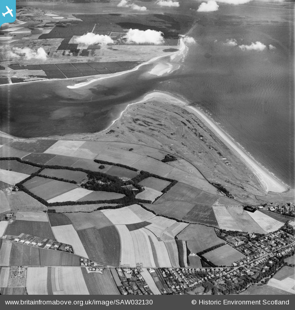
SAW032130 SCOTLAND (1950). The Links, St Andrews. An oblique aerial photograph taken facing north.
© Hawlfraint cyfranwyr OpenStreetMap a thrwyddedwyd gan yr OpenStreetMap Foundation. 2024. Trwyddedir y gartograffeg fel CC BY-SA.
Manylion
| Pennawd | [SAW032130] The Links, St Andrews. An oblique aerial photograph taken facing north. |
| Cyfeirnod | SAW032130 |
| Dyddiad | 1950 |
| Dolen | Canmore Collection item 1269705 |
| Enw lle | |
| Plwyf | ST ANDREWS AND ST LEONARDS |
| Ardal | NORTH EAST FIFE |
| Gwlad | SCOTLAND |
| Dwyreiniad / Gogleddiad | 349127, 717790 |
| Hydred / Lledred | -2.8232342926444, 56.349804200914 |
| Cyfeirnod Grid Cenedlaethol | NO491178 |
Pinnau
 Graham Yaxley |
Wednesday 18th of February 2015 10:56:18 PM | |
Kairt |
Tuesday 25th of February 2014 08:35:22 PM | |
Andy A |
Tuesday 7th of January 2014 11:41:18 AM |


