
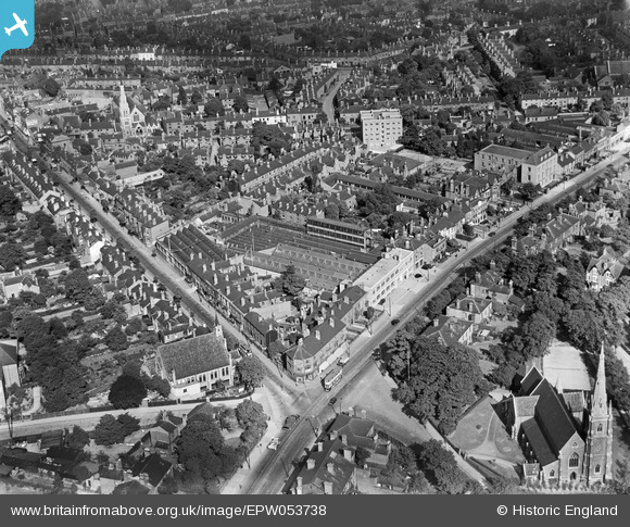
EPW053738 ENGLAND (1937). The Dennison Watch Case Works and St Michael's Church, Lozells, 1937
© Hawlfraint cyfranwyr OpenStreetMap a thrwyddedwyd gan yr OpenStreetMap Foundation. 2024. Trwyddedir y gartograffeg fel CC BY-SA.
Delweddau cyfagos (8)
EPW053738

EPW053737

EPW053735

EPW053734

EPW053736

EPW055221

EPW055219

EPW055220

Manylion
| Pennawd | [EPW053738] The Dennison Watch Case Works and St Michael's Church, Lozells, 1937 |
| Cyfeirnod | EPW053738 |
| Dyddiad | June-1937 |
| Dolen | |
| Enw lle | LOZELLS |
| Plwyf | |
| Ardal | |
| Gwlad | ENGLAND |
| Dwyreiniad / Gogleddiad | 405425, 289209 |
| Hydred / Lledred | -1.9200747645097, 52.500389466185 |
| Cyfeirnod Grid Cenedlaethol | SP054892 |
Pinnau
 Glassman |
Monday 8th of June 2015 06:49:11 PM | |
John Duffield |
Friday 20th of December 2013 05:14:53 PM | |
Glassman |
Friday 29th of November 2013 05:34:16 PM | |
Glassman |
Friday 29th of November 2013 05:33:23 PM | |
Glassman |
Friday 29th of November 2013 05:28:29 PM | |
Glassman |
Friday 29th of November 2013 05:25:44 PM | |
Glassman |
Saturday 31st of August 2013 05:41:07 PM | |
Glassman |
Saturday 31st of August 2013 05:38:10 PM | |
Glassman |
Saturday 31st of August 2013 05:34:09 PM | |
Glassman |
Saturday 31st of August 2013 05:33:19 PM | |
Glassman |
Saturday 31st of August 2013 05:32:48 PM | |
Glassman |
Saturday 31st of August 2013 05:32:18 PM |


