
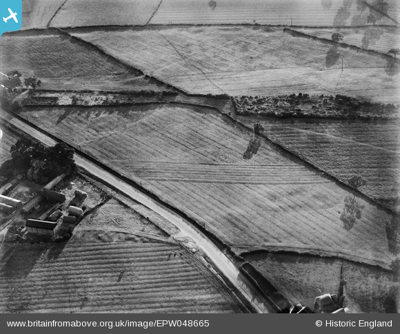
EPW048665 ENGLAND (1935). Farmland at Carrington's Farm, Smalley, 1935
© Hawlfraint cyfranwyr OpenStreetMap a thrwyddedwyd gan yr OpenStreetMap Foundation. 2024. Trwyddedir y gartograffeg fel CC BY-SA.
Delweddau cyfagos (48)
EPW048665

EAW011247

EAW018406

EAW011242

EAW011240

EAW012050

EAW017962

EAW011250

EAW018407

EPW048666

EAW018413

EAW011248

EAW012046

EAW025920

EAW012045

EAW012056

EAW018402

EAW025923

EAW017953

EAW012054

EAW011249

EAW017985

EAW012043

EAW018416

EAW017948

EAW018401

EAW018412

EPW048664

EAW011246

EAW011241

EAW017954

EAW017955

EAW012053

EAW011239

EAW018411

EAW017961

EAW025913

EAW011237

EAW011234

EAW011236

EAW012049

EAW011235

EAW018415

EAW025912

EAW018408

EAW012052

EAW017963

EAW033474

Manylion
| Pennawd | [EPW048665] Farmland at Carrington's Farm, Smalley, 1935 |
| Cyfeirnod | EPW048665 |
| Dyddiad | July-1935 |
| Dolen | |
| Enw lle | SMALLEY |
| Plwyf | SMALLEY |
| Ardal | |
| Gwlad | ENGLAND |
| Dwyreiniad / Gogleddiad | 441192, 345259 |
| Hydred / Lledred | -1.3861037440199, 53.002754701049 |
| Cyfeirnod Grid Cenedlaethol | SK412453 |
Pinnau
Cyfraniadau Grŵp
View looking west. |
 Class31 |
Monday 14th of April 2014 09:11:44 AM |
Thank you for the location! We'll update the catalogue and post the new data here in due course. Yours, Katy Britain from Above Cataloguing Team Leader |
Katy Whitaker |
Wednesday 8th of January 2014 10:23:25 AM |
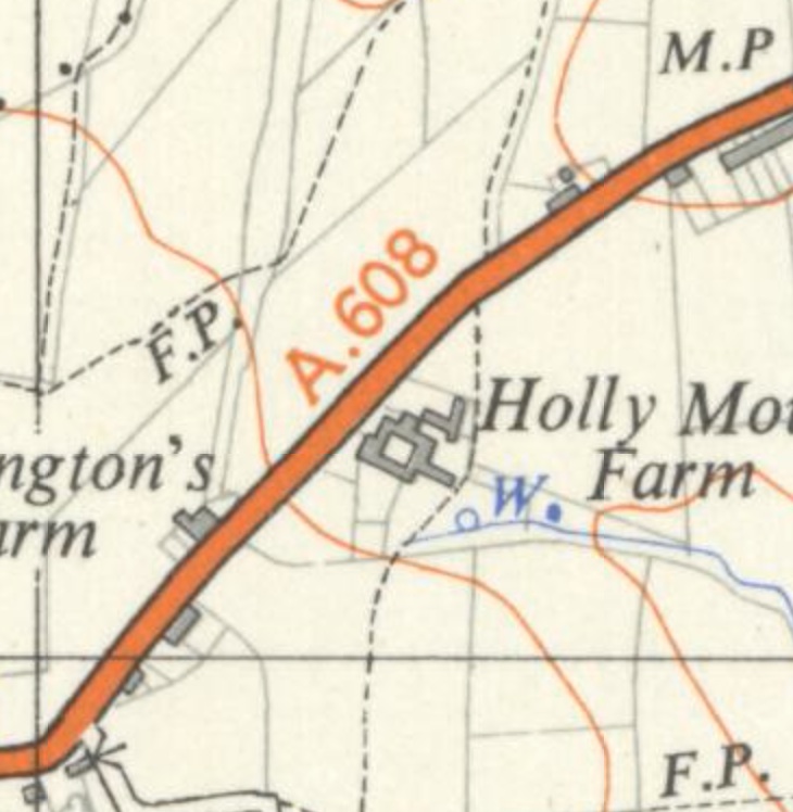 Double field boundary on OS Map |
 TomRobin |
Monday 9th of December 2013 05:53:24 PM |
Some interesting humps in this field - archaeological evidence? |
Tony D |
Friday 11th of October 2013 05:01:06 PM |
I think EPW048664 (EPW048665) EPW048666 EPW048667 are of same area. |
Andrew Bennett |
Sunday 6th of October 2013 11:26:19 PM |
See also EPW048666. |
BigglesH |
Thursday 16th of May 2013 01:58:48 AM |


