
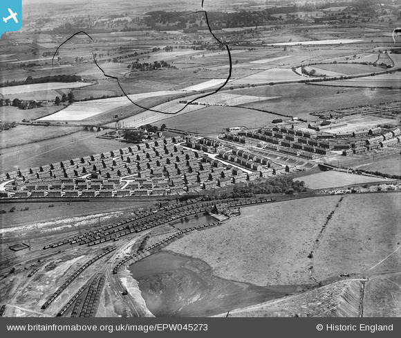
EPW045273 ENGLAND (1934). Housing estate at Whitwood Mere, Castleford, 1934. This image has been produced from a damaged negative.
© Hawlfraint cyfranwyr OpenStreetMap a thrwyddedwyd gan yr OpenStreetMap Foundation. 2024. Trwyddedir y gartograffeg fel CC BY-SA.
Delweddau cyfagos (4)
EPW045273

EPW045271

EPW045276

EPW045274

Manylion
| Pennawd | [EPW045273] Housing estate at Whitwood Mere, Castleford, 1934. This image has been produced from a damaged negative. |
| Cyfeirnod | EPW045273 |
| Dyddiad | July-1934 |
| Dolen | |
| Enw lle | CASTLEFORD |
| Plwyf | |
| Ardal | |
| Gwlad | ENGLAND |
| Dwyreiniad / Gogleddiad | 441041, 425431 |
| Hydred / Lledred | -1.3779450622299, 53.723444200928 |
| Cyfeirnod Grid Cenedlaethol | SE410254 |
Pinnau
 stephenfromnormanton |
Sunday 23rd of November 2014 06:05:31 PM | |
 Derekdye |
Sunday 8th of December 2013 08:25:00 PM | |
Derekdye |
Sunday 8th of December 2013 08:22:44 PM | |
Derekdye |
Sunday 8th of December 2013 08:21:36 PM | |
MB |
Monday 6th of May 2013 05:53:52 PM | |
MB |
Monday 6th of May 2013 05:43:52 PM | |
The 2 million tons output was the total for the Briggs Collieries group and included other sites at Ledston Luck, Peckfield, Saville and Merthley Junction, Snydale and Water Haigh |
MB |
Monday 6th of May 2013 05:53:16 PM |
MB |
Monday 6th of May 2013 05:40:54 PM | |
MB |
Monday 6th of May 2013 05:40:31 PM |


