
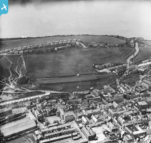
EPW042097 ENGLAND (1933). New Town and environs, Whitehaven, from the east, 1933

© Hawlfraint cyfranwyr OpenStreetMap a thrwyddedwyd gan yr OpenStreetMap Foundation. 2024. Trwyddedir y gartograffeg fel CC BY-SA.
Delweddau cyfagos (2)
EPW042097

EPW029185

Manylion
| Pennawd | [EPW042097] New Town and environs, Whitehaven, from the east, 1933 |
| Cyfeirnod | EPW042097 |
| Dyddiad | June-1933 |
| Dolen | |
| Enw lle | WHITEHAVEN |
| Plwyf | |
| Ardal | |
| Gwlad | ENGLAND |
| Dwyreiniad / Gogleddiad | 297245, 517839 |
| Hydred / Lledred | -3.5886418904403, 54.545237393133 |
| Cyfeirnod Grid Cenedlaethol | NX972178 |
Pinnau
 lesgilpin |
Wednesday 29th of April 2015 06:34:31 PM |
Cyfraniadau Grŵp
 9 |
MotoFreako64 |
Friday 14th of June 2013 08:48:23 PM |


