
EPW041411 ENGLAND (1933). The town, Brightlingsea, from the south-east, 1933

© Hawlfraint cyfranwyr OpenStreetMap a thrwyddedwyd gan yr OpenStreetMap Foundation. 2024. Trwyddedir y gartograffeg fel CC BY-SA.
Delweddau cyfagos (11)
EPW041411

EAW049472

EAW049473

EAW024663

EAW024664

EPW014282

EPW014285

EPW041414

EAW049471

EPW041412

EAW049470

Manylion
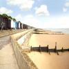
| Pennawd | [EPW041411] The town, Brightlingsea, from the south-east, 1933 |
| Cyfeirnod | EPW041411 |
| Dyddiad | May-1933 |
| Dolen | |
| Enw lle | BRIGHTLINGSEA |
| Plwyf | BRIGHTLINGSEA |
| Ardal | |
| Gwlad | ENGLAND |
| Dwyreiniad / Gogleddiad | 608635, 216014 |
| Hydred / Lledred | 1.0264662908186, 51.803329607003 |
| Cyfeirnod Grid Cenedlaethol | TM086160 |
Pinnau
 Fims |
Tuesday 11th of February 2014 05:52:04 PM | |
Fims |
Tuesday 11th of February 2014 05:50:19 PM | |
Paul S |
Thursday 3rd of October 2013 04:39:38 PM | |
Paul S |
Thursday 3rd of October 2013 04:38:20 PM | |
 Onthecoast |
Thursday 6th of June 2013 10:02:54 AM | |
Unlikely! The water tower that was demolished in 2011, was built some 20 years later… I believe this structure to be the pumping station. There was a Victorian water tower in Well Street (TM 0839 172). |
 Ferrers |
Friday 2nd of March 2018 08:38:53 AM |
Onthecoast |
Wednesday 5th of June 2013 01:24:28 PM | |
Onthecoast |
Wednesday 5th of June 2013 01:23:26 PM |


