
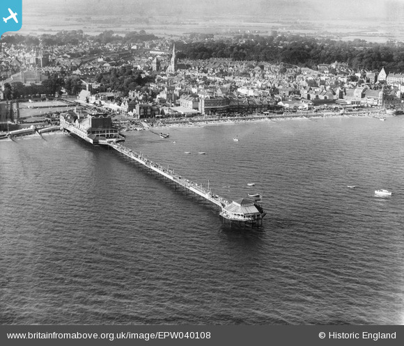
EPW040108 ENGLAND (1932). The pier and the town, Bognor Regis, from the south, 1932
© Hawlfraint cyfranwyr OpenStreetMap a thrwyddedwyd gan yr OpenStreetMap Foundation. 2024. Trwyddedir y gartograffeg fel CC BY-SA.
Delweddau cyfagos (7)
EPW040108

EAW046504

EAW046804

EAW046503

EAW046803

EAW022233

EAW022235

Manylion
| Pennawd | [EPW040108] The pier and the town, Bognor Regis, from the south, 1932 |
| Cyfeirnod | EPW040108 |
| Dyddiad | August-1932 |
| Dolen | |
| Enw lle | BOGNOR REGIS |
| Plwyf | BOGNOR REGIS |
| Ardal | |
| Gwlad | ENGLAND |
| Dwyreiniad / Gogleddiad | 493479, 98547 |
| Hydred / Lledred | -0.67396866587135, 50.778391308429 |
| Cyfeirnod Grid Cenedlaethol | SZ935985 |
Pinnau
 ordinarybloke |
Wednesday 4th of June 2014 01:34:33 PM | |
ordinarybloke |
Monday 17th of March 2014 04:55:57 PM |


